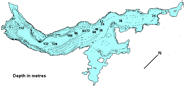
Lois
Lake
Click
on the lake icon at the right to see full bathymetric map.
Location:
Lois Lake is actually a reservoir approximately 14 km. (8.5 mi.)
long. It can be accessed by travelling south from the town of Powell
River approximately 20.2 km. and then turning northeast on Canoe
Main. Access is unrestricted on Canoe Main. The Lois Lake boat launch
is near the dam.
Resorts
& Campsites:
There is an organized camping area at the end of Canoe Main. This
is a lovely lake for paddle sports and swimming. Lots to explore!
The nearby communities of Powell River and Saltery Bay can provide
accommodations, services and facilities.
BC Adventure Network members serving this area:
If you would like to have your business listed, please Click Here.
Fishing
Report: It is best fished in spring and fall near feeder
creeks. Cutthroat can reach up to 3 lbs. Be sure to visit Fishbc.com
for angling information!
Viewscape:
Signs of logging are visible on the surrounding hillsides. Forests
consists of Douglas fir, Hemlock, Western Red cedar, Alder and Broad
Leaf maple.
Shoreline:
A drowned forest makes up most of the northwest shore of the lake;
there are extensive shoals of submerged stumps and dead upright
trees by the thousands.
Nearby
Lakes
Khartoum Lake: Khartoum is another large lake which
is connected to the northeast end of Lois Lake. Best fished near
the mouths of feeder creeks during spring and fall months, Khartoum
produces Cutthroats up to 4 lbs.
Note:
Always check your current BC Fishing regulations before you start
fishing a new lake.